

Elevation Harmonizer
“Ever tried merging two DEM rasters — like SRTM with a high-resolution survey DEM — and ended up with those […]
Elevation Harmonizer Read More »
“Ever tried merging two DEM rasters — like SRTM with a high-resolution survey DEM — and ended up with those […]
Elevation Harmonizer Read More »

This 2D simulation perfectly captures a hydraulic jump as supercritical flow rushes down the slope and transitions abruptly to subcritical
From 2D physics to immersive 3D visualization — all inside STE, STEGIS, and STEGeo3D Read More »

I’m thrilled to announce a powerful new feature coming to the next version of STE — the Real-Time Flood Inundation
🔥 New in STE: Real-Time Flood Inundation Mapper ⚡ Read More »

Watch ripples and dunes dynamically form in this 2D movable bed simulation using STE’s Sediment Module. These results highlight how
Bedform Evolution in Action! Read More »
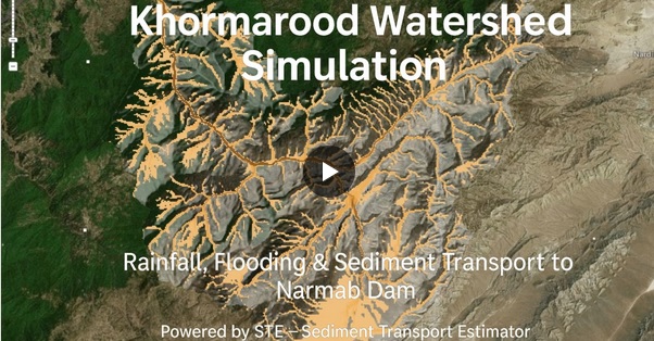
In this video, we use STE to simulate rainfall, flooding, and sediment movement across the Khormarood watershed. The results show
🌧️ How Much Sediment Does a Flood Bring? Read More »

I’ve just completed a brand-new tool in STEGIS that allows users to extract Elevation–Area and Elevation–Volume relationships for dam storage
New Tool Added to STEGIS: Extract Stage–Area–Volume Relation Read More »